The Mobility of Knowledge <
Wisdom is the daughter of experience
Leonardo da Vinci
Codex Forster III, fol. 14r
The knowledge gathered by Leonardo in his personal library is collective knowledge. It is based, first, on a long tradition dating back to antiquity, and second, on increasing human mobility since the late Middle Ages. Oceanic navigation and the growth of printing created another major push. Merchants traveled along the major trade routes and maintained branches in important urban centers; participants in the Crusades brought knowledge to Europe, especially from the Arab world; international scholars and students exchanged ideas at the universities thanks to the universal language of Latin; artists and master builders traveled across Europe and beyond in search of lucrative commissions and the latest artistic developments. Explorers on voyages of discovery undertook daring expeditions to hitherto unknown continents and brought back new knowledge, while the colonizers who followed them seized the newly discovered territories—with terrible consequences for their inhabitants. This new knowledge was recorded and published in the form of reports, stories, in increasingly precise geographical maps, and in new scientific treatises. The result was a constant expansion and transformation of the worldview. In Leonardo’s library, too, the share of this new knowledge continued to grow over the years.
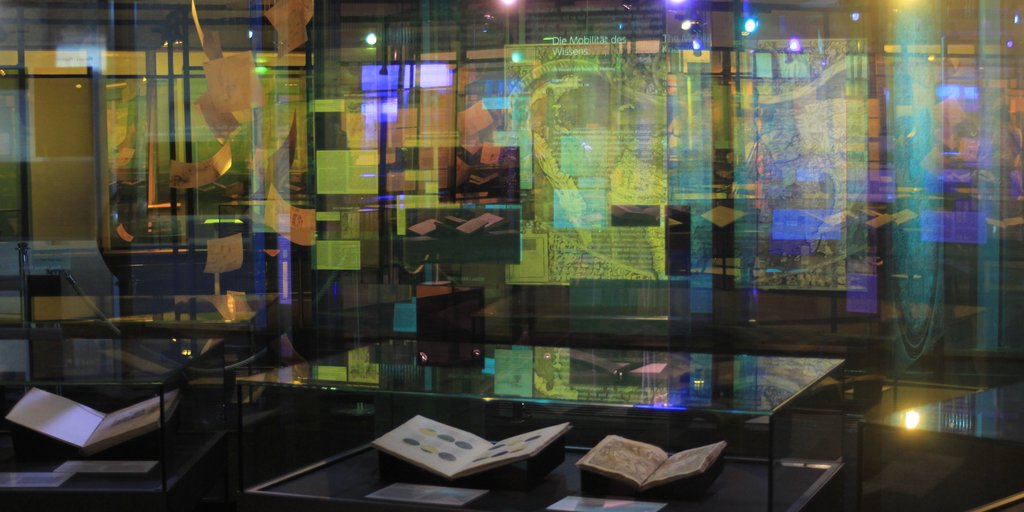
World in Motion <
- 101.
Mappa Mundi
ca. 1450
- 102.
Universalis cosmographia secundum Ptholemaei traditionem
et Americi Vespucii alioru[m]que lustrationes1507
- 103.
Das vierdte Buch von der Neuwen Welt. Oder neuwe und gründtliche Historien,
von dem Nidergängischen Indien, so von Christophoro Columbo im Jar 1492. erstlich erfunden1613
- 104.
Astrolabium (Amerigo Vespucci discovers the Southern Cross)
ca. 1590
- 105.
ca. 1491–1494
- 106.
ca. 1600
| 101.
Mappa Mundi ca. 1450 |
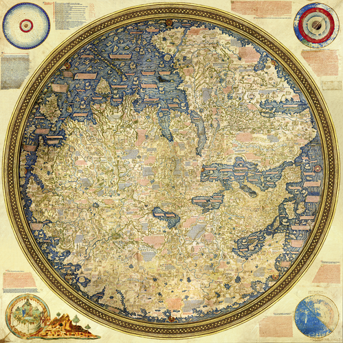
This monumental hand-drawn map of the world by Fra’ Mauro (died 1459) from the Camaldolese monastery of San Michele in Murano near Venice is the most important and graphically ambitious record of Western cartography from the time just before transoceanic discoveries began. While Ptolemy’s Cosmographia (90 ■) remained the basis for the worldview, innumerable commentaries show that people were rethinking the ideas of this ancient authority. At the same time, there was a demand for integration of new data from recent nautical maps, eyewitness accounts, or travelogues. This is evidenced by the extremely precise mapping of the Mediterranean region, the detailed knowledge of the Asian countries, and the depiction of the west coast of Africa, which was based exclusively on the reports of Portuguese voyagers and showed beyond doubt the African continent could be circumnavigated. In contrast, the map follows the tradition of medieval theology by placing the four cosmological schemata in the outer corners.
References
Cattaneo, Angelo. 2011. Fra Mauro’s Mappa Mundi and Fifteenth-Century Venice. Terrarum Orbis 8. Turnhout: Brepols.
Falchetta, Piero. 2006. Fra Mauro’s World Map. Terrarum Orbis 5. Turnhout: Brepols.
Vogel, Klaus Anselm. 2011. “Fra Mauro und der moderne Globus.” Der Globusfreund, no. 57/58: 83–94.